Texas Scenic Highways: 10 Drives Worth the Trip in 2026

You’re leaving Austin on Saturday morning with a full tank, a cooler, and no firm plan beyond getting out of town. The tempting move is to follow a winding road until something looks interesting. The better move is almost as spontaneous: choose a park, check what could prevent you from getting in, and let the scenic road connect the day.
These Texas scenic highways lead toward granite domes, mountain overlooks, desert canyons, Gulf beaches, and cypress waterways. Some are satisfying drives on their own. Others work best as the approach to a hike, paddle, or swim, where the destination matters more than the view through the windshield.
Texas has a formal heritage-driving tradition, not just a collection of attractive back roads. The Texas Department of Transportation’s Scenic Byways Program describes the original 10 pleasure-driving routes, established in 1967 and operational in 1968, that helped organize travel around the state’s historic, cultural, and geographic character.
For your own trip, keep the plan smaller. Pick a manageable road segment, leave time outside the car, and confirm current park access before departure.
- Choose the anchor activity: A summit hike, reserved swim, or guided paddle gives the day a practical shape.
- Identify the weak point: Fuel, ferry waits, heat, foliage timing, and entry restrictions can matter more than mileage.
- Treat travel estimates cautiously: Distances and drive times are estimates, and traffic, stops, and conditions can change the day.
Table of Contents
- 1. Ranch Road 12 (RR 12) Wimberley Scenic Drive
- 2. Enchanted Rock Road (Ranch Road 965)
- 3. Lost Maples Scenic Drive (Ranch Road 187)
- 4. Davis Mountains Scenic Loop (Highway 118 and Ranch Road 166)
- 5. Ranch Road 170 River Road (Big Bend Region)
- 6. Ross Maxwell Scenic Drive (Big Bend National Park)
- 7. Texas Highway 87 Bolivar Peninsula Drive
- 8. Park Road 22 (Padre Island Drive)
- 9. Texas Highway 71 Hill Country Corridor (Austin to Llano)
- 10. Caddo Lake Scenic Route (FM 2198 and Texas Highway 43 Corridor)
- How the 10 Texas Scenic Highways Compare
- Pick One Drive and Plan the Full Day
1. Ranch Road 12 (RR 12) Wimberley Scenic Drive
Best pairing: Blue Hole Regional Park or another confirmed Wimberley natural-area visit. Main constraint: swimming access.
Ranch Road 12 offers a gentle introduction to Hill Country driving, with wooded slopes, limestone scenery, and the small-town pull of Wimberley. It suits a relaxed outing from Austin or San Antonio, especially when you want lunch and a short nature stop rather than an ambitious hike.
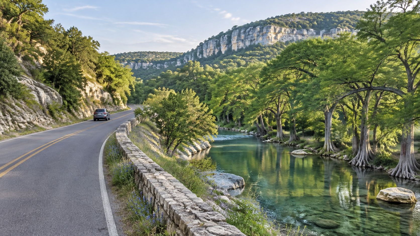
The important distinction is ownership. Blue Hole Regional Park isn’t a Texas state park, and nearby creek access doesn’t automatically mean public swimming access. Check each destination’s managing agency for reservations, seasonal swimming availability, parking, and pet restrictions.
Build the day around confirmed water access
Say you’re bringing children for a swim. Secure that access first, then arrange the drive and meal around it, rather than promising a swimming hole and discovering the swimming area is unavailable.
- Summer timing: Aim for an early arrival, but don’t assume arriving early replaces a required reservation.
- Weather check: Review flood advisories and water conditions before entering a creek or river.
- Backup activity: Keep a dry-land walk or town stop available if swimming closes.
For a state-park-focused weekend, treat Wimberley as a separate outing rather than forcing an unrelated park into the route. This drive works because it leaves room to linger, not because it checks off multiple destinations.
2. Enchanted Rock Road (Ranch Road 965)
Best pairing: Enchanted Rock State Natural Area. Main constraint: entry availability and exposed-rock heat.
The approach along Ranch Road 965 trades busy town streets for open ranchland, granite outcrops, and broad Hill Country views. It’s a particularly satisfying drive when the destination gradually becomes the main feature of the view.
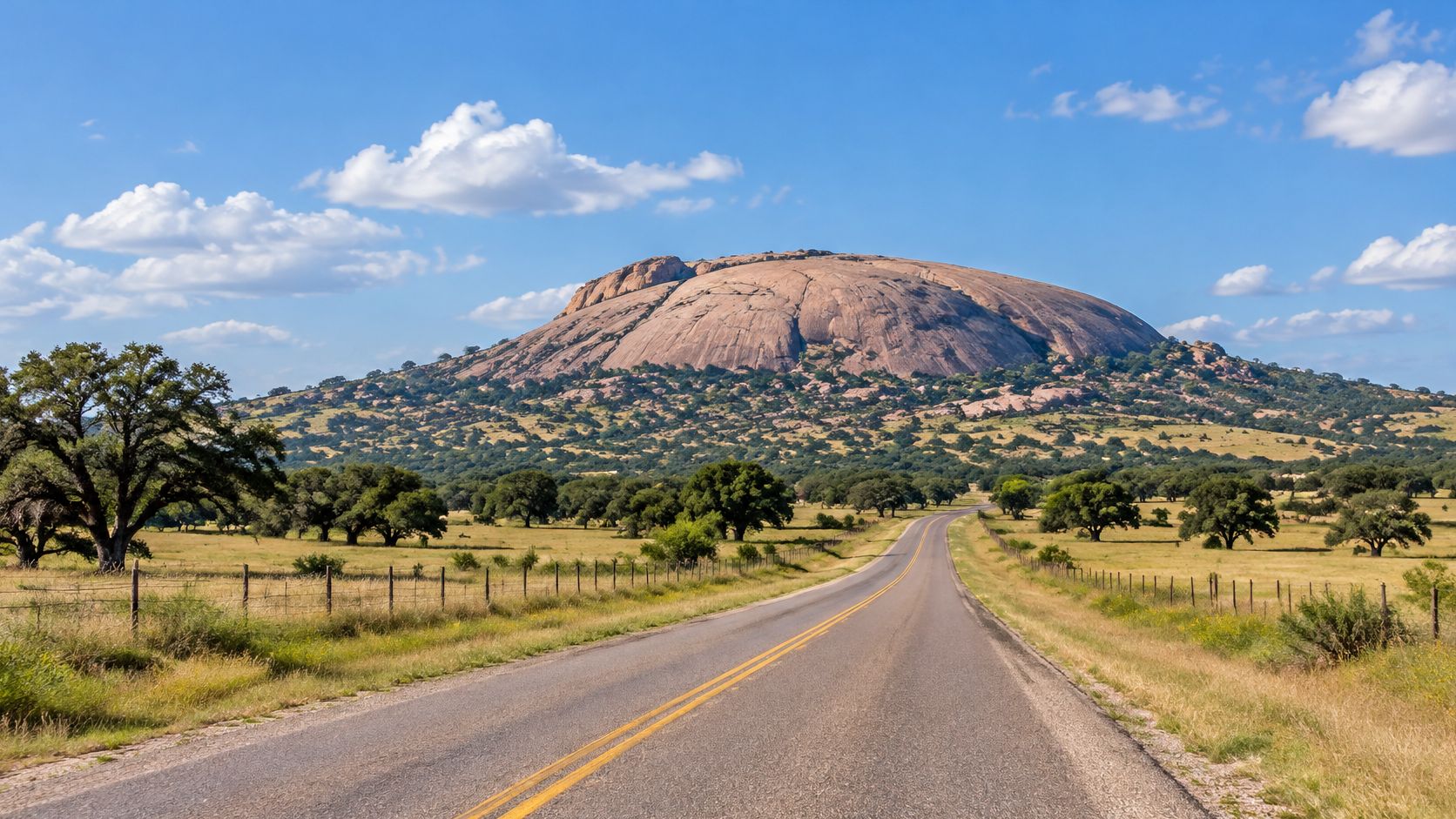
Use our Enchanted Rock planning guide to review the visit essentials, then confirm current entry requirements and alerts with the park. A scenic approach isn’t a substitute for confirmed admission, particularly when your whole day depends on hiking.
Plan the hike before the photography
For a family outing, choose a morning hike and a relaxed meal afterward. Sunset photography is appealing, but it requires checking permitted access hours and allowing enough daylight for a safe descent.
- Fuel first: Fill up in Fredericksburg or Llano before committing to the rural approach.
- Download navigation: Save the route and park information before leaving reliable reception.
- Pack for exposure: Carry drinking water, sun protection, and shoes with dependable traction.
If you’re traveling with a dog, check the rules for the specific trail, not just whether pets may enter the natural area. A park can permit dogs in some places while restricting them elsewhere. That distinction can determine whether your planned hike works at all.
3. Lost Maples Scenic Drive (Ranch Road 187)
Best pairing: Lost Maples State Natural Area. Main constraint: foliage timing and peak-season entry.
Choose this drive for wooded hills, river valleys, and an outdoor day that doesn’t depend entirely on autumn color. The maple foliage is the attraction many visitors chase, but a fixed calendar date can’t guarantee the conditions you want.
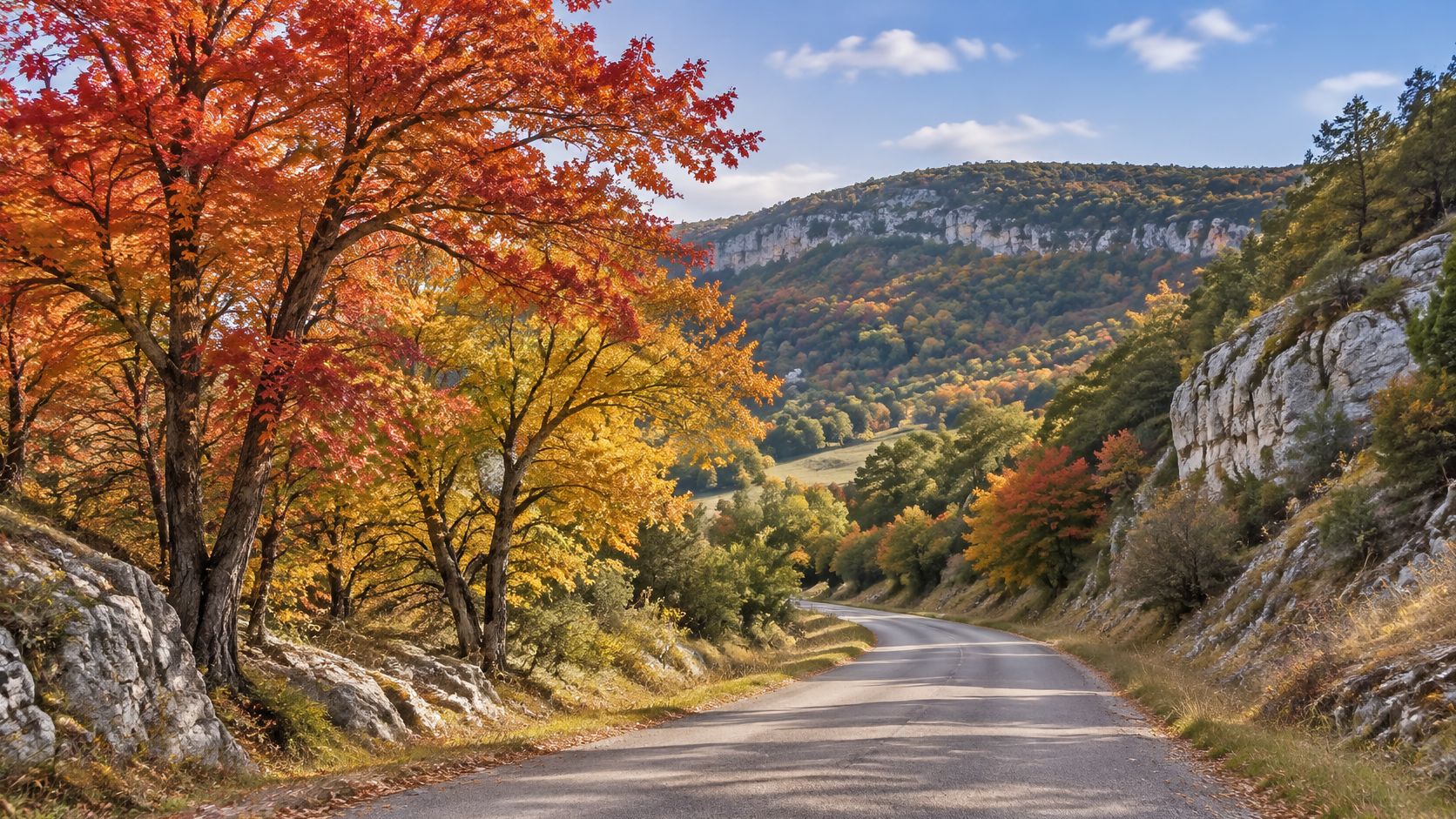
Start with our Lost Maples fall foliage guide, then check current park reports and entry availability. Book around actual conditions when possible, rather than assuming the same weekend produces the same color each year.
A worthwhile Lost Maples day should still work if the leaves aren’t at their brightest. Choose a walk you’d enjoy without the autumn photographs.
A practical use case is a weekday photography outing with a short walk, picnic, and unhurried return drive. That leaves room to stop at permitted viewpoints without squeezing in a strenuous hike just because you’ve already driven there.
- Autumn flexibility: Keep your travel date adjustable if foliage is the main reason for going.
- Parking reality: Arrive early within your permitted entry arrangements, especially during popular periods.
- Trail conditions: Check closures and recent weather before choosing a route.
Bring layers for a cool start, but don’t confuse cool air with an easy hike. Uneven ground, climbs, and the return walk still deserve a realistic assessment of everyone’s ability.
4. Davis Mountains Scenic Loop (Highway 118 and Ranch Road 166)
Best pairing: Davis Mountains State Park. Main constraint: fitting mountain driving around a scheduled evening program.
A Davis Mountains day works best when you decide early whether it’s a hiking trip, a scenic loop, or an observatory evening. Trying to give all of them equal time can leave you rushing the road and arriving tired for the event you most wanted.
The route around Fort Davis combines open grasslands with mountain slopes and long views. Davis Mountains State Park makes a useful outdoor anchor, while the McDonald Observatory area adds a different reason to stay after dark.
Choose an evening anchor
For a stargazing weekend, confirm the observatory’s current program schedule and booking requirements first. Then plan a modest daytime park visit, a meal, and enough rest before the evening activity.
- Fuel and food: Buy supplies in town before starting the more rural stretches.
- Warm layers: Pack a jacket even when the afternoon feels warm.
- Seasonal checks: Review mountain weather before departure, particularly when cold or stormy conditions are possible.
Mountain driving and stargazing don’t have to happen on the same tired return journey. Staying nearby can be the better choice when an evening program finishes after dark.
For families, a park overlook and short walk may be more enjoyable than completing every possible road segment. Keep the loop flexible enough to shorten it if weather, fatigue, or an unexpectedly good stop changes your priorities.
5. Ranch Road 170 River Road (Big Bend Region)
Best pairing: Big Bend Ranch State Park. Main constraint: remote services and desert heat.
Commonly called River Road, this route is signed FM 170. The drive between the Presidio and Terlingua areas follows the Rio Grande through rugged desert country, with steep terrain and canyon views that deserve your full attention.
The Texas scenic-byway eligibility overview includes FM 170 in the Big Bend region among the state’s eligible corridors. Eligibility isn’t a road-condition report, so check current access separately.
This preview gives a sense of the scenery before you choose your stops.
Keep the roadside plan realistic
A good cooler-season day combines the paved drive with a permitted picnic stop and a short park walk. Don’t assume an interior park destination is an easy extension of the highway trip. Confirm the access road, vehicle requirements, and expected conditions with park staff.
- Refuel before departure: Don’t base your fuel plan on finding an open business later.
- Carry reserves: Bring extra drinking water, food, a spare tire, and a basic emergency kit.
- Set a turnaround: Decide when you’ll head back before a late departure becomes an after-dark scramble.
The main road and the park interior are different planning problems. A comfortable highway drive doesn’t establish that your vehicle or supplies are suitable for a remote side trip.
6. Ross Maxwell Scenic Drive (Big Bend National Park)
Best pairing: Big Bend National Park, with Big Bend Ranch State Park as a separate regional day. Main constraint: heat and overambitious scheduling.
Ross Maxwell Scenic Drive isn’t a state highway. It’s a paved national park road, included because it complements a broader Big Bend trip without repeating the River Road experience.
Desert washes, striking rock formations, and mountain views make this a drive for deliberate stops. The mistake is treating every overlook as a quick photograph and every nearby trail as something you can add without changing the schedule.
Desert rule: Choose the walk first, give it the coolest practical part of the day, and let the driving fill the remaining time.
For example, a photographer might start with a short morning walk, rest through the hottest part of the day, and return to selected overlooks when the light improves. A family with young children might skip a longer trail and concentrate on safe roadside viewpoints instead.
Keep the park boundaries clear
Big Bend National Park and Big Bend Ranch State Park have different management, entry arrangements, and alerts. Check the National Park Service’s current information for this drive rather than relying on a state-park reservation.
Download maps, carry a paper backup, and plan for limited phone reception. Water, fuel, and daylight are more useful scheduling tools than an optimistic navigation estimate. Don’t make this an obligatory add-on after an already full River Road outing.
7. Texas Highway 87 Bolivar Peninsula Drive
Best pairing: Bolivar beaches and wetlands, with Galveston Island State Park as a separate island-side stop. Main constraint: ferry waits.
If you’re approaching from Galveston, the ferry is part of the outing, not a minor connection to squeeze between appointments. Highway 87 then gives you access to the peninsula’s beach communities, coastal habitats, and open shoreline scenery.
Birders can make a rewarding day from wetland stops and a beach walk. Families may prefer a simple picnic outing, especially if a long ferry queue would make a more elaborate schedule stressful.
Decide which side gets the full day
Galveston Island State Park isn’t on the Bolivar Peninsula. Pairing it with this drive means allowing for travel across the island and the ferry crossing, so don’t describe it to your passengers as a nearby stop along the same road.
- Before leaving: Check ferry operating information and current wait estimates.
- At the beach: Verify local access points, parking requirements, and beach-driving rules.
- During stormy weather: Reconsider the trip if coastal alerts make access uncertain.
Ferry time is the variable to leave open, especially if you have a meal reservation or a park entry window later.
For a relaxed weekend, give Bolivar its own day and visit Galveston Island State Park separately. If you must combine them, choose your priority destination and make the other optional rather than letting a queue derail both visits.
8. Park Road 22 (Padre Island Drive)
Best pairing: Padre Island National Seashore, or a separate detour to Mustang Island State Park. Main constraint: confusing paved access with beach-driving access.
Park Road 22 leads toward the beaches, dunes, and wetlands of Padre Island National Seashore. It’s a coastal drive best followed by time out of the car, whether that means birdwatching, a beach walk, or a planned camping stay.
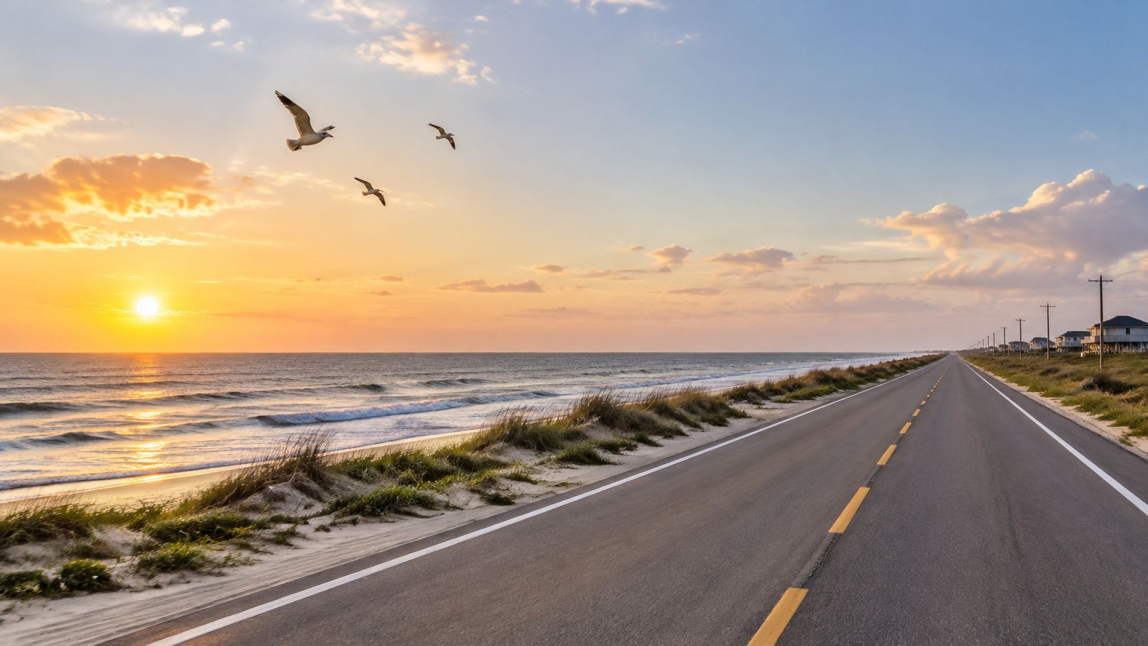
Mustang Island State Park offers a state-park alternative in the wider coastal area, but it isn’t the endpoint of this road. Choose which managed destination you’re visiting before checking fees, camping arrangements, or pet policies.
Keep sand driving optional
A family beach day doesn’t need to become a vehicle-recovery problem. Start with a designated parking area and an accessible beach visit unless you’ve confirmed that your vehicle, equipment, and current conditions suit driving farther.
- Check conditions: Review tides, weather, and current beach-access notices.
- Pack for wind: Bring secure shade equipment and avoid loose items that blow away.
- Separate the rules: National seashore and state-park permissions aren’t interchangeable.
For a birdwatching trip, binoculars and a flexible walking plan are more useful than an ambitious driving itinerary. Don’t plan around a guaranteed wildlife sighting or public turtle event. Check current announcements if a particular activity is central to your visit, and retain a worthwhile beach-day backup.
9. Texas Highway 71 Hill Country Corridor (Austin to Llano)
Best pairing: Inks Lake State Park via connecting roads. Main constraint: treating a regional corridor as a direct park-access road.
Highway 71 makes a useful starting point for exploring the Hill Country northwest of Austin, but it doesn’t directly deliver every lake town and park associated with the region. Marble Falls, Llano, and Inks Lake require a deliberately mapped itinerary using connecting roads.
That distinction matters when you’re planning a day rather than a weekend. Choose the park first, then decide which part of the corridor adds scenery without unnecessary backtracking.
Make the lake activity the anchor
For a paddling outing at Inks Lake State Park, confirm park entry and current activity conditions before deciding where to stop for breakfast. Bring dry clothes and allow enough time to pack wet equipment before the return drive.
- Water checks: Review current lake conditions, water-quality advisories, and launch access.
- Traffic allowance: Leave room for delays around growing towns and busy intersections.
- Park rules: Confirm pet restrictions for the particular swimming or shoreline areas you intend to use.
Roadworks can also change the character of an otherwise appealing approach. TxDOT’s transportation investment presentation documents substantial construction activity across Texas, a reminder to check the actual segment rather than assuming the familiar route is unchanged.
Use designated stops, not construction shoulders, for photographs. If the drive is disrupted, spend longer at the park instead of chasing an improvised roadside viewpoint.
10. Caddo Lake Scenic Route (FM 2198 and Texas Highway 43 Corridor)
Best pairing: Caddo Lake State Park. Main constraint: securing water access before the drive decides your day.
FM 2198 is the park approach, with Texas Highway 43 and the smaller connectors carrying you through piney woods, small communities, wooded shorelines, and the first cypress channels. The road sets up the visit; the lake still has to be entered.
Caddo Lake is a poor windshield gamble. The famous moss and flooded timber sit back in the waterways, so build the day around a launch, boat outing, or shoreline stop rather than a continuous scenic view. If staying overnight solves the timing problem, use the Caddo Lake camping guide to base the trip at the park.
Leave enough time to be on the water. A long scenic approach followed by a rushed launch misses the reason to come.
Book the water piece first for a first visit. Confirm the meeting point, equipment, weather policy, and whether the route suits everyone in your group.
- Reserve the activity: arrange the rental or guided trip before it becomes the day’s centerpiece.
- Prepare for humidity: pack drinking water, insect repellent, and sun protection.
- Check the launch: water levels and access conditions can change where the outing begins.
Save an offline map even with a guide lined up. A road map leaves you short on paddling navigation, and an appealing channel can still be the wrong return route.
How the 10 Texas Scenic Highways Compare
Read the Main Caution column first. The right drive is the one whose biggest risk you can plan around, whether that is fuel, heat, ferry timing, or parking.
| Item | Region | Best Season | Nearby State Park | Main Caution |
|---|---|---|---|---|
| Ranch Road 12 (RR 12) Wimberley Scenic Drive | Hill Country, Wimberley Valley | Spring or fall; summer is busiest | Pedernales Falls State Park | Weekend traffic, sharp curves, and limited parking |
| Enchanted Rock Road (Ranch Road 965) | Hill Country, near Fredericksburg | Spring and fall | Enchanted Rock State Natural Area; Inks Lake State Park | Few services and limited cell coverage |
| Lost Maples Scenic Drive (Ranch Road 187) | Hill Country, near Lost Maples | Late autumn | Lost Maples State Natural Area | Peak-season crowds and variable foliage timing |
| Davis Mountains Scenic Loop (Highway 118 and Ranch Road 166) | West Texas, Davis Mountains | Spring and fall | Davis Mountains State Park; Balmorhea State Park | Remote area; plan fuel, food, and lodging |
| Ranch Road 170 River Road (Big Bend Region) | Big Bend, West Texas | Cooler months | Big Bend Ranch State Park | Extreme summer heat and very limited services |
| Ross Maxwell Scenic Drive (Big Bend National Park) | Big Bend, West Texas | Cooler months | Big Bend Ranch State Park | Heat, limited shade, and few services |
| Texas Highway 87 Bolivar Peninsula Drive | Upper Texas Coast, Bolivar Peninsula | Mild weather outside storm season | Galveston Island State Park; Sea Rim State Park | Hurricane and flood risk; ferry waits |
| Park Road 22 (Padre Island Drive) | South Texas Coast, Corpus Christi area | Cooler months | Padre Island State Park | Heat, sun exposure, and tide-dependent beach access |
| Texas Highway 71 Hill Country Corridor (Austin to Llano) | Central Texas Hill Country | Spring or fall | Inks Lake State Park; Longhorn Cavern State Park | Weekend traffic and changing lake conditions |
| Caddo Lake Scenic Route (FM 2198 and Texas Highway 43 Corridor) | East Texas, Caddo Lake | Spring or fall | Caddo Lake State Park | Mosquitoes, humidity, and variable water access |
The Hill Country routes forgive a loose schedule; the West Texas and coastal drives do not. Fuel gaps, summer heat, storms, and ferry waits punish vague planning on those rows. Even a short stop changes the math: Enchanted Rock’s Summit Trail runs 0.8 mile and is steep, so a quick detour still earns an early start in warm weather.
Pick One Drive and Plan the Full Day
The best choice among these Texas scenic highways is the one that fits the activity you want to do. Pick Enchanted Rock for a granite-country hike, the Davis Mountains for a mountain-and-night-sky weekend, or Caddo Lake for time on the water. Choose a coastal drive when you’re happy to let wind, tides, and ferry conditions shape a looser schedule.
Then identify the constraint most likely to spoil the outing. A full fuel tank won’t solve a missing entry reservation, and an early start won’t guarantee fall color. Check the vulnerable part of the plan before adding restaurants, viewpoints, or another park.
Confirm access before adding distance
Build your day around a confirmed destination and a realistic return. For a rural drive, that means fuel, water, navigation, and a turnaround decision. For a beach or lake outing, it means checking access conditions and knowing what you’ll do if swimming, boating, or sand driving isn’t suitable.
Keep a backup that avoids the same problem. Another low-water crossing isn’t a useful alternative during flooding, and another exposed desert trail doesn’t solve dangerous heat. Choose a different activity or postpone the trip when conditions make the original plan unsafe.
- Check the right authority: Use the managing agency’s current alerts for park access, ferry operations, and road restrictions.
- Read activity-specific rules: Pet permission at the entrance doesn’t establish permission on every trail, beach, or swimming area.
- Keep stops legal: Use designated parking and pullouts, and respect private property along scenic roads.
Our guide puts fees, pet rules, and swimming status near the top of park pages, with official-source citations and a last-checked date. We’re independent and aren’t affiliated with or endorsed by TPWD, so the official park page remains the place to confirm alerts, closures, and changed rules before departure.
The Texas State Park Travelers app is free, with no ads or in-app purchases. Campsite and day-pass reservations are made on the official Texas State Parks reservation site, not through our guide; the app’s Reserve button opens that official booking page.
Choose a route you can enjoy without rushing. Confirm the park, arrange the main activity, fill up before the rural stretch, and leave enough daylight for the return. A scenic road becomes a better trip when you have time to stop safely and enjoy what it leads to.
Visit TX State Parks to compare park access, camping options, swimming availability, and pet rules before choosing your drive. Use the regional map and estimated drive times to build a manageable day, then follow the official park links to confirm conditions and reserve your visit.
Fees, hours and rules change. Check the park's official TPWD page before you go.